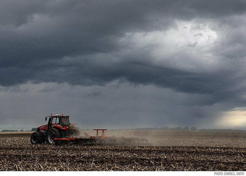
Rain Or Drought? What to Expect from the Weather Following the End of La Niña?
After three years of La-Niña-driven weather, scientists at the Climate Prediction Center (CPC) say the cold water along the equatorial Pacific is showing signs of warming. The CPC in January said there’s now an 82% chance for ENSO-neutral by spring.
“It will take a period of a few months for the pattern to completely break down but in the process, we will have opportunities for breaks from the pattern that's been so prevailing,” says Drew Lerner, president at World Weather Inc. “As La Niña diminishes, we will lose that persistent below-normal-precipitation bias.”
That is good news for Argentina, along with winter wheat country, the Southwest and California in the U.S.
“Soil moisture going into spring is an understated but impactful driver of seasonal weather,” says Kirk Hinz, a meteorologist at BAMwx.com. “If we start dry, it’s easier to end dry. If we go through the spring wetter, then we’re more likely to retain that kind of pattern.”
RETURN OF 2012?
These transition years can be hard to predict, Hinz says. The modern mark remains 2012.
“The year before was a La Niña and as we went into the summer of 2012, it was just below an El Niño,” Hinz says. “This isn’t one-to-one, but we are trending in a similar direction (towards a more ENSO-neutral pattern) and we are at a pivotal point over the next 30 to 60 days.”
While an El Niño is often associated with better chances for rain throughout the Southwest and Plains, the CPC says there’s less than a 40% chance it arrives between June and August.
“When we’re talking about the La Niña relaxing, it isn’t all about going to El Niño,” says Brian Bledsoe, chief meteorologist at KKTV 11 in Colorado Springs. “A lot of times it’s just about not dealing with La Niña or El Niño and being neutral for a little bit, which allows us to see better moisture.”
WATCH THE PDO
The ENSO twins aren’t the only influences in town but they tend to be the loudest. However, as La Nina ends, both Lerner and Bledsoe say they’ll watch the Pacific Decadal Oscillation (PDO) for clues.
“A strongly negative PDO allows for more troughing to come into the west coast and if you put a trough of low pressure in the western part of North America, in the middle of the country, you put a ridge of high pressure,” says Lerner.
He says while rains are likely to fall this spring, if a negative PDO prevails, the Midwest is likely to go right back into a dryer bias during summer.
“As of December, we were at 17 months in a row of what I call a strong, negative PDO,” says Lerner. “We haven't had 17 months of strong negative PDO and our recorded history [going back to 1950].”
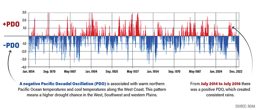
“The PDO operates on a 25-to-30-year cycle and so since the late 90s It's been in a cold and negative phase,” Bledsoe said.
Research confirms the impact. According to one study, in the southwestern U.S. 2000–2021 was the driest 22-yr period since at least 800.
“We have to get the PDO to flip to at least a short-term warm phase to really capitalize on the moisture,” said Bledsoe. “While it's quite negative right now I do see some evidence that it could possibly flip, if nothing else, to a less negative or even neutral phase, by later this year.”
He says, looking at historical patterns, a more positive PDO is due to arrive anytime.
“Once you see it change you need to do everything you can to capitalize on that moisture,” said Bledsoe, who grew up in a ranching family in southeast Colorado.