New Land Analysis Tool Puts a Twist on Plat Book Concept
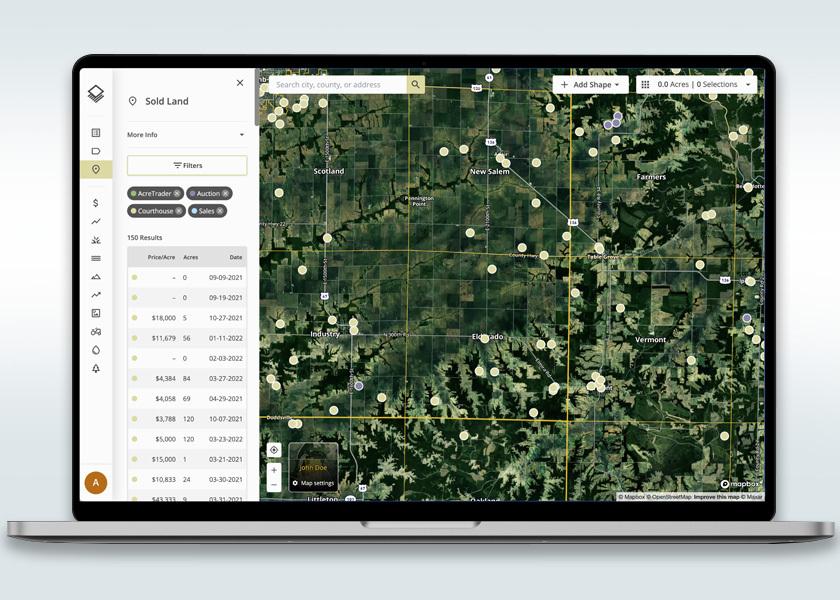
Putting a modern-day spin on the trusty plat book, AcreTrader is launching Acres, a land analysis platform that provides access to comprehensive data for 150 million U.S. parcels, local insights and comparable sales.
As the company describes, Acres’ in-house team aggregates and analyzes public and private data into one easy-to-use tool. The platform provides users with simple and intuitive analysis of more than 10 layers of data on a given parcel of land, such as public owner records, soil and crop information, historical satellite imagery, vegetation indexes, water use and comparable sales.
“Technology has provided numerous tools to make smarter portfolio management decisions and more accurate asset valuations. However, until now, these tools have largely been unavailable across the broader land industry and asset class,” says Justin Ge, a former analyst, trader and data scientist who now leads the Acres team. “Through Acres, landowners and land professionals can leverage a substantial amount of data and land value insights to make the most informed buying or selling decisions and to improve the value of their land.”
Users can “claim their land” to create custom maps (with drawing tools, icons and notes), upload photos and share reports. The Acres platform also includes the ability to browse more than 12 million land sales to help better understand the value of farmland.
Acres offers pricing plans ranging from a free account for landowners to premium and enterprise levels for brokers, land professionals and land finance companies. The platform is available for desktop and mobile.